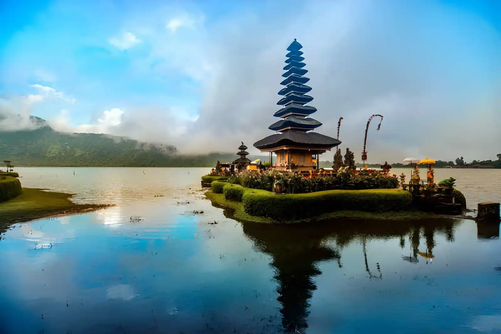
Bali, often called the Island of the Gods, may look relatively compact on a map, but its landscape changes dramatically from the busy southern coast to the mountains, rice-growing highlands, volcanic east, and quieter northern and western regions.
Understanding where each area sits makes it much easier to choose where to stay, group destinations, and build a Bali trip around the experiences you actually want.
Bali Tourist Map at a Glance
A Bali tourist map is most useful when you look at the island as a collection of distinct travel areas rather than one single destination. The table below gives you a quick orientation before looking more closely at each region.
| Area | Main Destinations | Best Known For | Typical Trip Style |
|---|---|---|---|
| South Bali | Kuta, Legian, Seminyak, Canggu, Uluwatu, Nusa Dua, Jimbaran, Sanur | Beaches, nightlife, resorts | Beach & leisure |
| Central Bali | Ubud, Bedugul, Tabanan | Culture, rice terraces, mountains | Culture & nature |
| East Bali | Amed, Candidasa, Padang Bai, Besakih, Kintamani | Volcanoes, diving, temples | Nature & adventure |
| North Bali | Lovina, Singaraja | Waterfalls, black-sand coast, quieter landscapes | Slow travel |
| West Bali | Negara, Medewi, Pemuteran, West Bali National Park | Surf, diving, nature | Off-the-beaten-path |
These are tourism-oriented regions rather than official administrative divisions. Administratively, Bali consists of eight regencies and one city, while travel planning commonly uses broader geographic groupings to make the island easier to understand.
Understanding the Island’s Geography and Regions
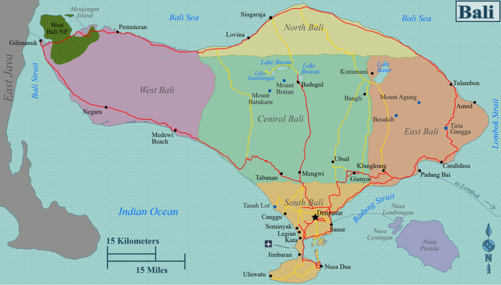
Bali sits between Java and Lombok, with the Bali Strait separating it from Java to the west and the Lombok Strait separating it from Lombok to the east.
The island’s landscape is shaped by a mountain chain running broadly from west to east, with volcanic peaks including Mount Batur and Mount Agung forming important reference points when reading a tourist map.
For trip planning, think of Bali through a few broad geographic characteristics:
- The south is the most developed tourism zone, with the highest concentration of beaches, hotels, restaurants, nightlife and major visitor infrastructure.
- The interior becomes increasingly mountainous, with Ubud, Bedugul and surrounding highland areas offering a very different landscape from the coast.
- East Bali combines mountains and coastline, with destinations such as Kintamani, Amed, Candidasa and Besakih spread across a much more varied landscape.
- North Bali has a quieter coastal and highland character, with Lovina, Munduk and surrounding waterfalls offering a slower alternative to the south.
- West Bali is more sparsely developed for tourism, with Medewi, Pemuteran and West Bali National Park appealing to people looking for surfing, diving and nature.
This geography matters because two destinations that appear relatively close on a map can still require substantial road travel, particularly when routes cross the island’s mountain areas or busy southern corridors.
South Bali Tourist Map
South Bali is the most important area to understand if this is your first trip to the island. It contains the greatest concentration of established tourism infrastructure, from Kuta and Legian through Seminyak and Canggu, as well as resort-focused areas such as Nusa Dua and the coastal landscapes of Jimbaran and Uluwatu.
Kuta & Legian
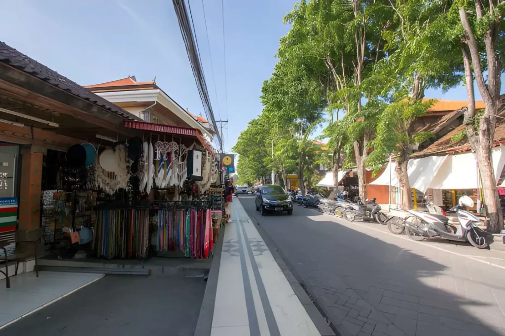
Best for: first trips, nightlife, shopping and budget-to-mid-range stays
Kuta and Legian sit along Bali’s developed southwest coast and remain among the easiest areas for a first visit. Kuta Beach is known for its surf-friendly coastline and lively atmosphere, while Legian Beach provides another long stretch of west-facing coast with easy access to hotels, restaurants and nightlife.
The area works particularly well if convenience matters:
- Wide choice of budget and mid-range accommodation
- Easy access to beaches and sunset
- Large selection of restaurants and casual dining
- Shopping and nightlife close to major hotel areas
- Relatively convenient access from Ngurah Rai International Airport
Kuta tends to feel busier and more commercial, while Legian provides a useful middle ground between Kuta and Seminyak. Their position also makes them practical bases if you want to explore several parts of South Bali without staying in a resort enclave.
Read more: Guide to Staying in Legian Bali: Best Areas, Costs & Tips
Seminyak
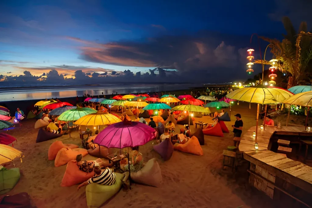
Best for: dining, beach clubs, shopping and sunset
Seminyak sits north of Legian and has a more lifestyle-oriented character. Instead of relying primarily on its beach as the main attraction, the area is known for the combination of restaurants, cafés, boutiques, spas, beach clubs and upscale accommodation that surrounds the coastline.
Its appeal is particularly strong if your Bali trip revolves around food and leisure. You can spend the afternoon around the beach, move into a restaurant for dinner and continue to a beach club or bar without needing to travel far between experiences.
Seminyak also works as a useful reference point on a Bali map because it marks the transition from the established southern tourist belt toward the more spread-out coastal areas around Canggu.
Read more: 14 Best Things to Do in Seminyak: Bali’s Most Lively Coastal Area
Canggu

Best for: surfing, cafés, beach clubs and longer stays
Canggu occupies the coast farther north of Seminyak and has developed into one of Bali’s most active lifestyle and surf areas. The main areas commonly associated with Canggu include Batu Bolong, Berawa and Echo Beach, each with a slightly different mix of accommodation, restaurants, cafés and beach activity.
Canggu is particularly useful for people who want:
- Surfing close to their accommodation
- Large café and restaurant selection
- Beach clubs and sunset venues
- A strong social and nightlife scene
- More choice for longer stays
The main consideration is traffic. Canggu’s popularity has brought substantial road congestion, and short distances on a map can take considerably longer at busy times. This makes the exact location of your accommodation more important than it may initially appear.
Read more: 12 Best Things to Do in Canggu (Beaches, Cafes & Hidden Spots)
Sanur

Best for: relaxed beach stays, families and access to the Nusa islands
Sanur sits on Bali’s southeast coast and has a noticeably calmer character than much of the southwest tourist belt. Its coastline is associated with a long beachfront pathway, sunrise views and a more relaxed beach atmosphere.
Sanur is also important geographically because it is one of Bali’s main departure areas for boat trips toward Nusa Penida and Nusa Lembongan. That makes it particularly useful if an island excursion forms part of your wider itinerary.
Rather than choosing Sanur for nightlife, people generally choose it for:
- A quieter coastal base
- Sunrise by the sea
- Family-friendly beach time
- Walkable beachfront areas
- Convenient access to nearby islands
Read more: 12 Best Things to Do in Sanur Bali for a Relaxing Sunrise Beach Escape
Nusa Dua
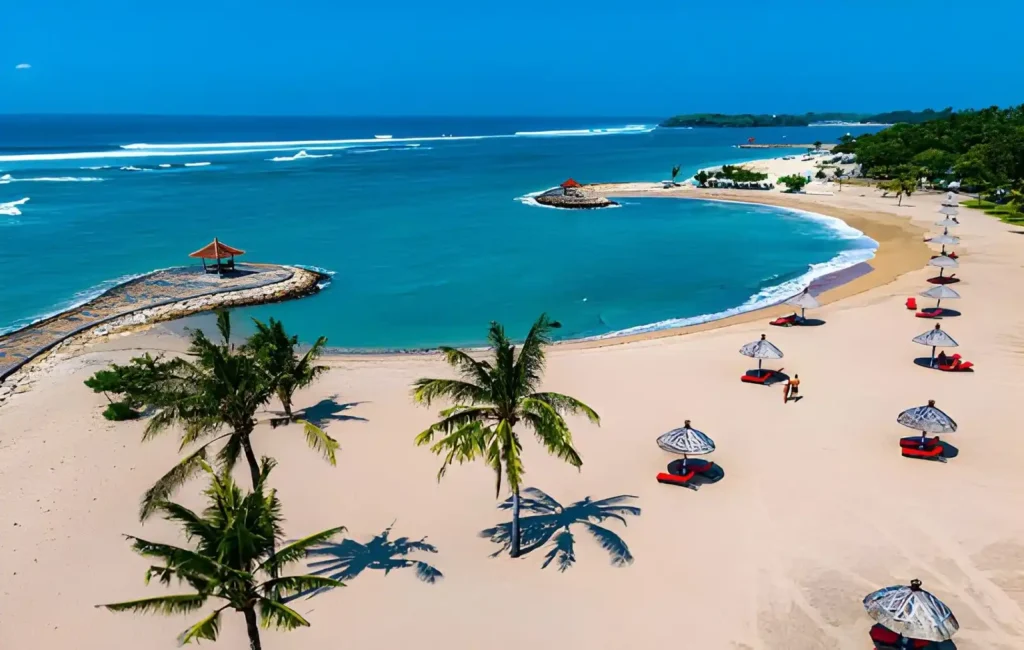
Best for: resorts, families and luxury stays
Nusa Dua occupies the southeastern part of Bali’s Bukit Peninsula and has a distinctly resort-oriented layout. Large hotels and integrated resort properties dominate much of the area, creating an experience that is more self-contained than the streets of Seminyak, Canggu or Legian.
The area suits a hotel-focused holiday where you want:
- Resort facilities
- Managed beachfront areas
- Swimming and watersports
- Restaurants within or around major properties
- A more controlled and relaxed environment
Nusa Dua is therefore less about exploring a dense network of nightlife streets and more about enjoying the facilities and coastline around your chosen resort.
Read more: 9 Luxury Things to Do in Nusa Dua for a Five-Star Bali Experience
Jimbaran
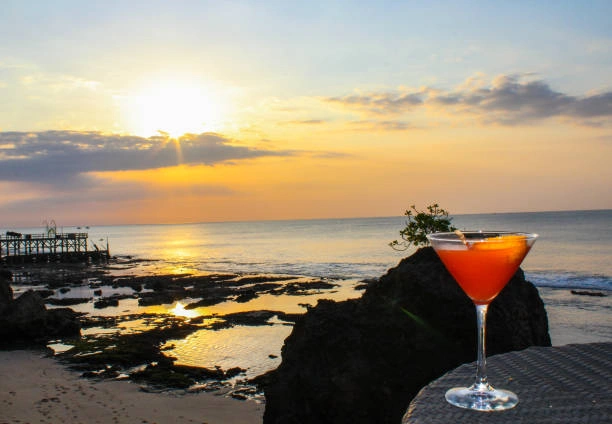
Best for: seafood, sunset and resort stays
Jimbaran sits on the southern side of the Bukit area and is best known for its coastal setting and seafood dining. Its beachfront restaurants make sunset and dinner a natural combination, while the surrounding area also contains a mix of resorts, villas and residential streets.
On a tourist map, Jimbaran is useful as a southern coastal base between the airport area and the Bukit Peninsula. It can work particularly well if you want a resort stay while keeping access to southern beaches and the airport relatively convenient.
Uluwatu & Bukit Peninsula
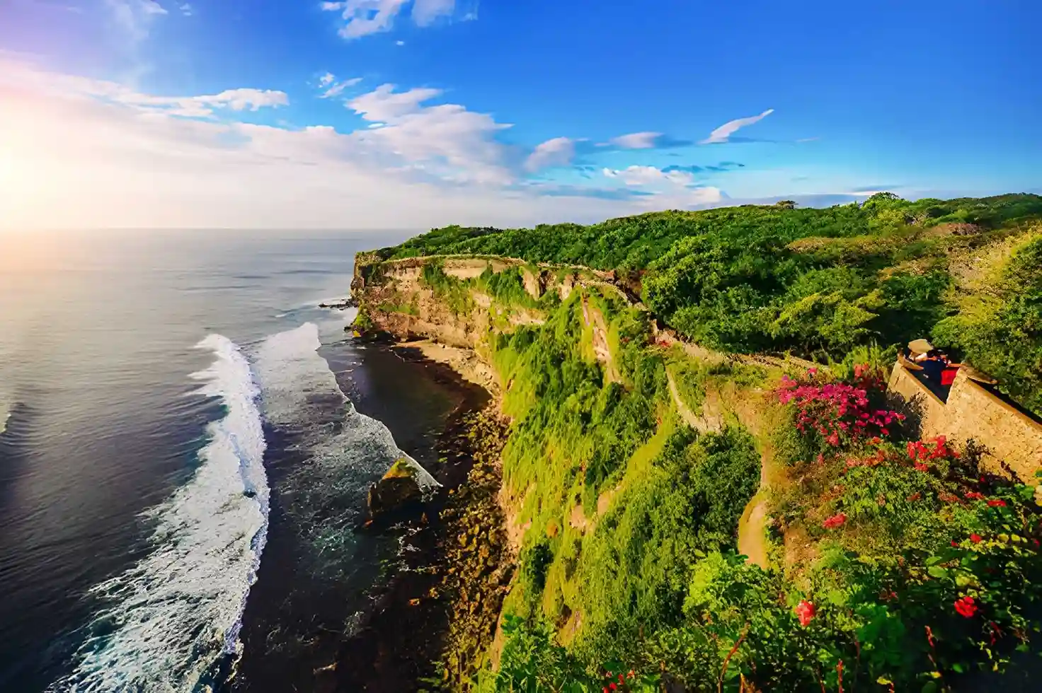
Best for: cliffs, surfing, luxury stays and dramatic sunsets
Uluwatu should be understood as part of the wider Bukit Peninsula, rather than simply as the location of one famous temple. The peninsula includes a collection of coastal areas and villages such as Uluwatu, Pecatu, Bingin and Padang-Padang, each offering different combinations of cliffs, beaches, surf breaks, villas, resorts and restaurants.
This part of South Bali is especially distinctive because the coastline rises into dramatic limestone cliffs before dropping toward the Indian Ocean. Surf destinations such as Uluwatu, Bingin and Padang-Padang have become important parts of the peninsula’s identity, while the elevated setting creates some of Bali’s most recognizable coastal views.
For map planning, the Bukit Peninsula makes sense if your priorities include:
- Cliffside scenery
- Surfing
- Luxury villas and resorts
- Sunset viewpoints
- Beach experiences below the cliffs
- A more destination-led stay away from the central Kuta–Seminyak corridor
Central Bali Tourist Map
Moving inland changes the character of Bali considerably. Instead of the continuous coastal development found across much of the south, Central Bali is shaped by rice-growing landscapes, valleys, forests and highland terrain. Ubud, Tegalalang, Bedugul and Tabanan each offer a different reason to move away from the coast.
Ubud

Best for: culture, rice terraces, wellness and jungle scenery
Ubud is the best-known inland tourism centre in Bali and is widely associated with the island’s arts, culture and surrounding agricultural landscapes. The town itself is dense with restaurants, galleries, spas, hotels and cultural venues, while the wider Ubud area extends into villages, rice fields and forested valleys.
This distinction matters when reading a Bali map: staying in central Ubud and staying in the wider Ubud area are not the same experience.
Central Ubud works well if you want restaurants, cafés, galleries and cultural attractions within easy reach. The outskirts are better suited to people looking for villas, rice-field views, jungle settings and a quieter environment.
Read more: 20 Things to Do in Ubud When You Want a Deeper Bali Experience
Tegalalang & North Ubud
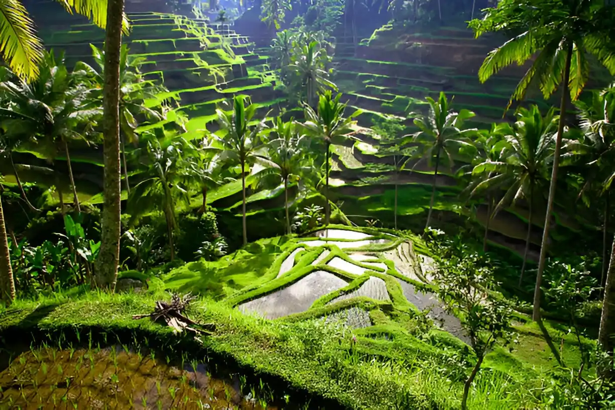
Best for: rice terraces, villages, nature and countryside
North of central Ubud, the landscape becomes increasingly rural, with rice terraces, traditional villages and natural attractions forming a major part of the experience. Tegalalang is particularly associated with its terraced agricultural landscape and is an important reference point when exploring the northern side of the Ubud area.
This part of the map is useful for understanding why an “Ubud trip” can involve much more than the town centre. Many of the experiences associated with Ubud are actually spread across the surrounding countryside.
Bedugul
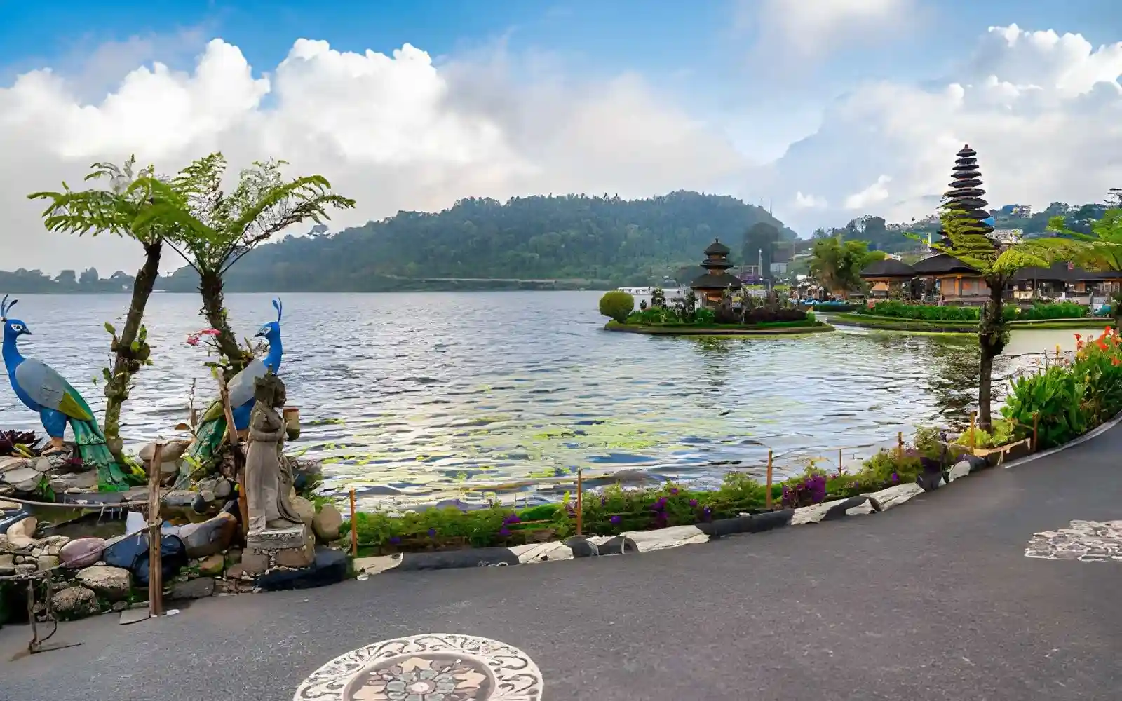
Best for: cool highlands, lakes, temples and gardens
Bedugul occupies Bali’s central highlands and feels distinctly different from the warmer coastal areas. The region is centred around mountain landscapes and lakes, with Lake Beratan, Ulun Danu Beratan Temple, Bali Botanic Garden and the Wanagiri area among its best-known attractions.
Its elevation also makes the climate noticeably cooler, particularly in the morning and evening. On a Bali tourist map, Bedugul is therefore best understood as a highland destination rather than simply another stop north of Ubud.
Tabanan
Best for: temples, rice terraces and quieter west-central Bali
Tabanan covers a large part of west-central Bali and includes a mixture of agricultural landscapes, villages, mountains and coastline. It is particularly useful to understand geographically because destinations associated with Tabanan stretch from inland rice-growing areas toward the western coast.
Tanah Lot is one of the most recognizable landmarks in this broader region, while the inland parts of Tabanan offer a much quieter landscape of rice fields, villages and mountain scenery.
For a Bali map, Tabanan helps connect the central highlands with the western side of the island rather than functioning as a single concentrated tourist hub.
East Bali Tourist Map
East Bali is where Bali’s geography becomes more volcanic, mountainous, and coastal at the same time. This part of the island is especially useful to understand when you want to go beyond the main southern tourist areas and combine mountain scenery, temples, diving, and quieter coastal villages.
Kintamani
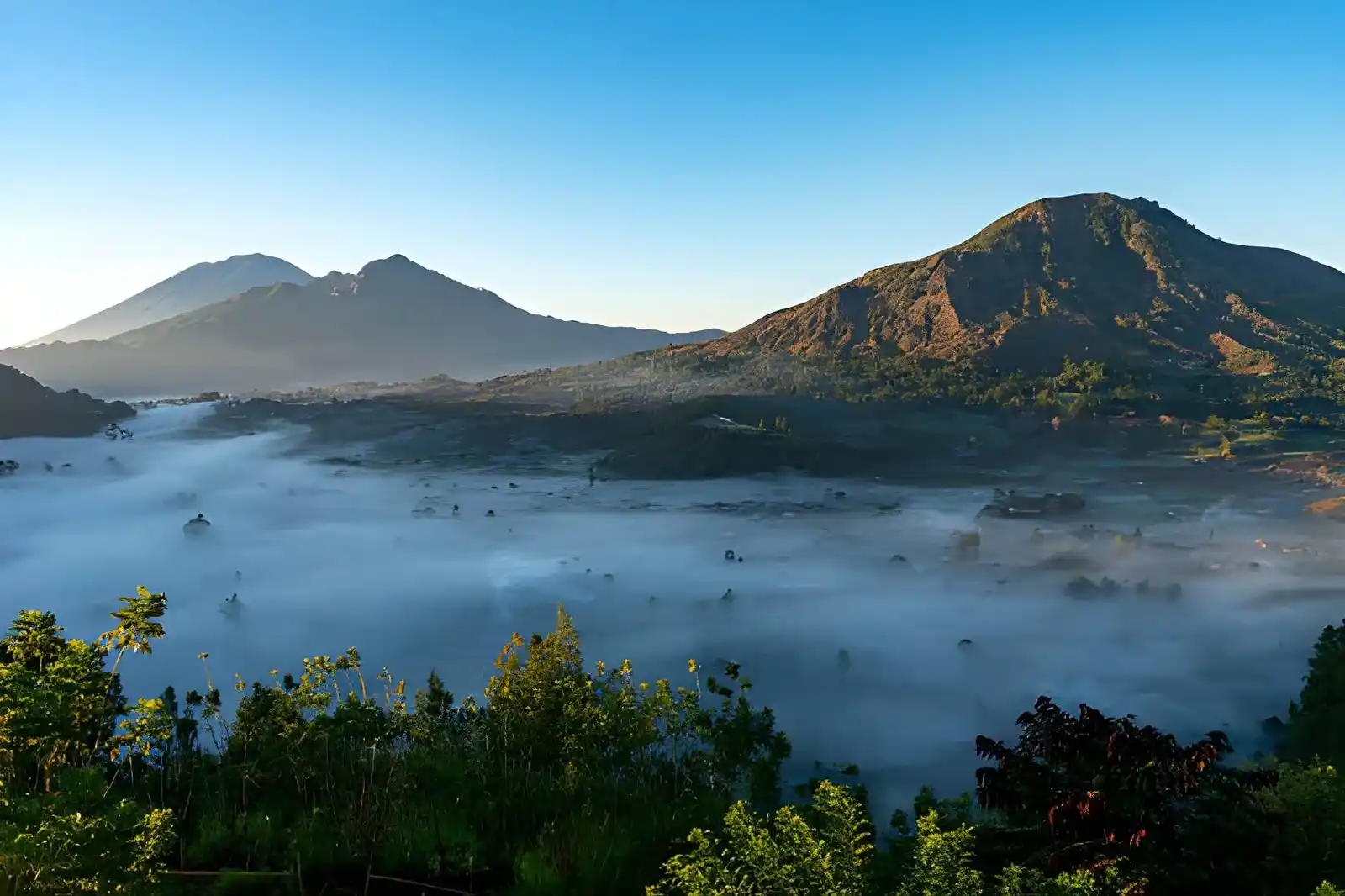
Best for: Mount Batur, Lake Batur, volcanic landscapes
Kintamani sits around the caldera of Mount Batur and offers a very different landscape from southern Bali. The area is defined by Mount Batur, Lake Batur, volcanic slopes, and highland villages, making it one of the main geographic anchors of central-to-eastern Bali.
Penelokan and surrounding viewpoints are coPenelokan Viewpoint Bali: Best Mount Batur Views Without the Hikemmonly used to take in the caldera landscape, while the wider Kintamani area provides access to Mount Batur and Lake Batur experiences.
Read more: 12 Best Things to Do in Kintamani: A Complete Guide to Bali’s Volcano and Lake Region
Amed
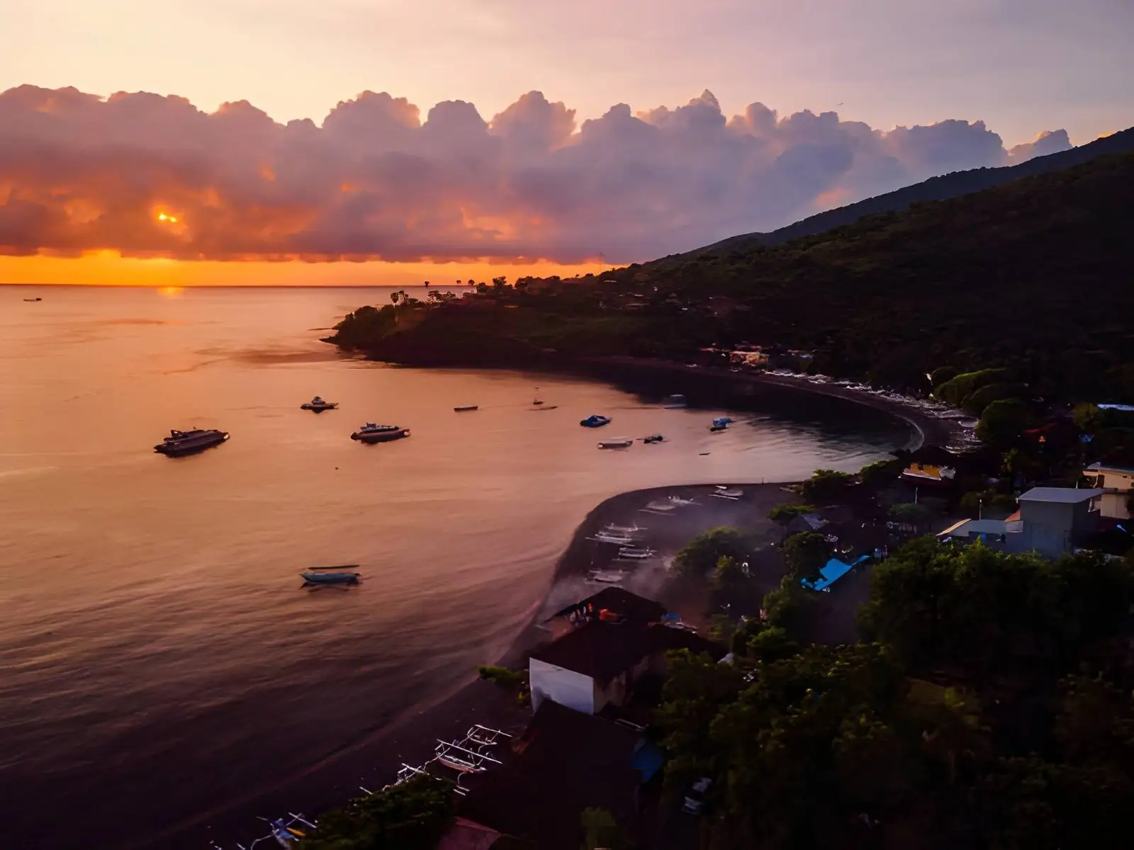
Best for: diving, snorkeling, sunrise, and coastal villages
Amed stretches along Bali’s northeastern coast and is known for its combination of dry coastal hills, fishing villages, black-sand beaches, and underwater attractions.
It is one of the island’s established diving and snorkeling areas, with destinations such as Jemeluk Bay and nearby Japanese Shipwreck sites adding to its marine appeal. Its east-facing coastline also makes Amed particularly relevant for sunrise experiences.
Read more: 10 Incredible Things to Do in Amed for Nature, Diving & Coastal Views
Candidasa
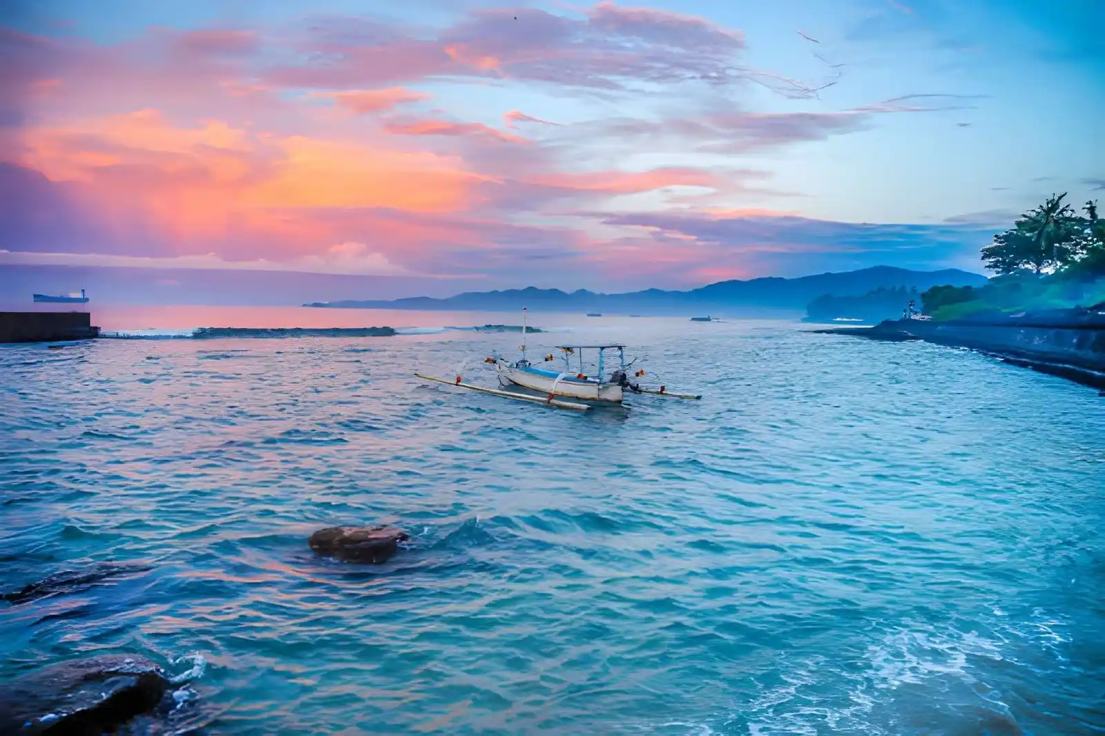
Best for: quieter coastal stays and East Bali exploration
Candidasa is a coastal town in Karangasem that works well as a base for exploring eastern Bali. Its location places you within reach of destinations such as Tenganan, Tirta Gangga, Amed, and other parts of Karangasem, while the town itself has a more relaxed coastal character than the major resort areas in South Bali.
Read more: Best Things to Do in Candidasa for an East Bali Escape
Besakih & Mount Agung
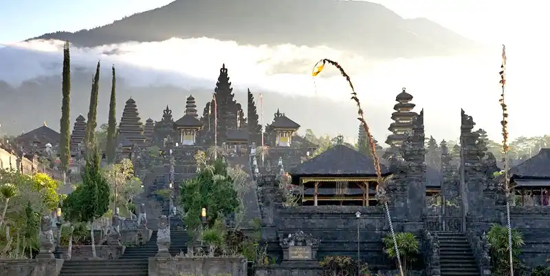
Best for: temples, sacred landscapes, and mountain scenery
The Besakih area sits on the southwestern slopes of Mount Agung, Bali’s highest mountain and one of the island’s most sacred landscapes. Pura Besakih, widely known as Bali’s Mother Temple, forms the religious centerpiece of the area. On a tourist map, this part of East Bali is important because it connects the island’s mountain geography with one of its most significant Hindu temple complexes.
Read more: Guide to Besakih Temple: Fees, Etiquette, What to See & More
Padang Bai
Best for: East Bali access and boat connections
Padang Bai is a small port town on Bali’s east coast and an important transport point for sea connections to other Indonesian islands. It is also useful geographically when planning an East Bali itinerary because it sits between destinations around Candidasa and the wider Karangasem area. For anyone traveling beyond Bali, Padang Bai can therefore function as both a coastal destination and a practical gateway.
North Bali Tourist Map
North Bali has a noticeably different rhythm from the heavily developed south. The coastline, former colonial-era city of Singaraja, mountain villages, waterfalls, and forested landscapes make this region particularly useful for understanding how much of Bali remains outside the main southern tourism corridor.
Lovina
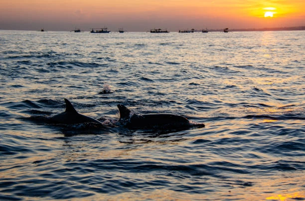
Best for: quieter beaches and dolphin experiences
Lovina is located along Bali’s northern coast and is known for its black-sand shoreline, calmer coastal atmosphere, and early-morning dolphin excursions.
The coastline is spread across several villages rather than functioning as one compact resort district, giving Lovina a different spatial character from areas such as Kuta or Seminyak.
Singaraja
Singaraja is the main urban center of North Bali and was historically an important administrative and trading city. Its position on the northern coast makes it a useful geographic reference when moving between Lovina, the mountain interior, and other northern destinations.
Unlike Bali’s major southern resort areas, Singaraja feels more like a functioning regional city than a dedicated holiday enclave.
Munduk
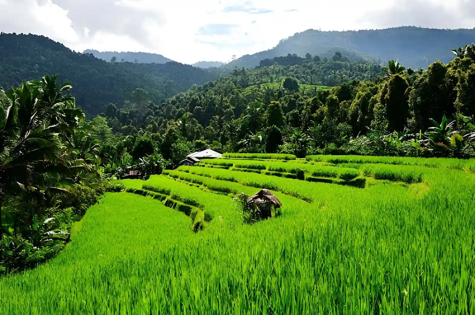
Best for: waterfalls, mountain scenery, and cooler weather
Munduk sits in Bali’s northern highlands, where the landscape rises into forested hills and agricultural areas.
The area is associated with waterfalls, coffee and clove-growing landscapes, mountain views, and cooler temperatures, making it a natural contrast to the warm coastal regions. Munduk also provides a useful route between the central highlands and North Bali.
Read more: Munduk Travel Guide: Bali’s Hidden Mountain Gem for Waterfalls & Nature Lovers
North Bali Waterfalls
North Bali contains numerous waterfalls and forest attractions spread through its mountainous interior. Rather than treating them as one concentrated attraction zone, it is more useful to understand them as part of the region’s elevated, forested geography.
Banyumala, Gitgit, and Sekumpul are among the better-known names, but distances and road conditions mean they should be considered according to the area you are staying in.
West Bali Tourist Map
West Bali is the least connected to the main South Bali tourism corridor, and that distance helps explain its different character. The region combines quieter surf beaches, marine environments, protected forests, and Bali’s western gateway toward Java.
Medewi
Best for: surfing and quieter coastal stays
Medewi is a small coastal destination on Bali’s west coast, best known for its long left-hand surf break and relatively peaceful surroundings. Compared with Canggu or Seminyak, development is much lighter, making Medewi more relevant for surfers and anyone looking for a slower coastal base.
Pemuteran
Best for: diving, snorkeling, and marine experiences
Pemuteran sits on Bali’s northwest coast and is one of the island’s main gateways to the underwater attractions around the Bali Barat region. The area is known for diving, snorkeling, coral restoration projects, and access toward Menjangan Island. Its location also makes it a useful base for exploring the western side of Bali rather than returning toward the southern resort corridor each day.
West Bali National Park
Best for: nature and wildlife
West Bali National Park occupies a large protected area in the island’s northwest and includes forests, mangroves, savanna-like landscapes, coastal habitats, and surrounding marine areas. It is best understood as a nature destination rather than a conventional sightseeing district, with the park’s protected environment providing a strong contrast to Bali’s highly developed southern coast.
Gilimanuk
Best for: Java ferry connections and Bali’s western gateway
Gilimanuk sits at the westernmost end of Bali and serves as the island’s main ferry gateway to Java. Its importance on a Bali tourist map is therefore partly geographic: it marks where Bali’s road network connects with the ferry crossing to East Java. This makes the area particularly relevant for overland itineraries that combine Bali with Java.
How Far Apart Are Bali’s Main Tourist Areas?
Understanding Bali’s map is more useful when you think about connections between regions rather than exact distances alone.
Bali may look compact on a tourist map, but road conditions, congestion, winding mountain routes, and local traffic can make neighboring destinations take considerably longer than their straight-line distance suggests.
Some of the most useful geographic relationships are:
- Ngurah Rai Airport → Kuta / Legian / Jimbaran / Seminyak: the main southern resort corridor begins close to the airport.
- Kuta → Seminyak → Canggu: these areas form a broadly connected west-coast tourism corridor, although traffic can make movement slow.
- Kuta → Sanur: crossing toward Bali’s southeastern coast connects the main west-coast resort zone with Sanur.
- Sanur → Ubud: the route moves inland from the southeast coast toward central Bali.
- Ubud → Kintamani: traveling north from Ubud takes you into Bali’s volcanic highlands.
- Ubud → East Bali: routes continue east toward Karangasem, Besakih, Candidasa, and Amed.
- Sanur → Nusa Penida: Sanur is one of the main departure points for fast-boat connections to Nusa Penida.
- Padang Bai → East Bali: Padang Bai provides a useful coastal access point for destinations across Karangasem.
Use the Map to Build a Smarter Bali Trip
A Bali tourist map becomes much more useful when you understand which destinations naturally fit together instead of trying to cover the entire island from one base.
South Bali is centered around beaches, nightlife, and resorts, Central Bali brings culture and highland landscapes, while East, North, and West Bali offer increasingly different combinations of volcanoes, temples, diving, nature, and quieter coastal areas.
Bali Island Vacations can help you turn that geographic picture into a more practical Bali itinerary, with destinations grouped around the experiences you actually want to enjoy.